Avalanche terrain maps

These are valuable map layers indicating potential avalanche starting zones as well as possible avalanche runout and other information.

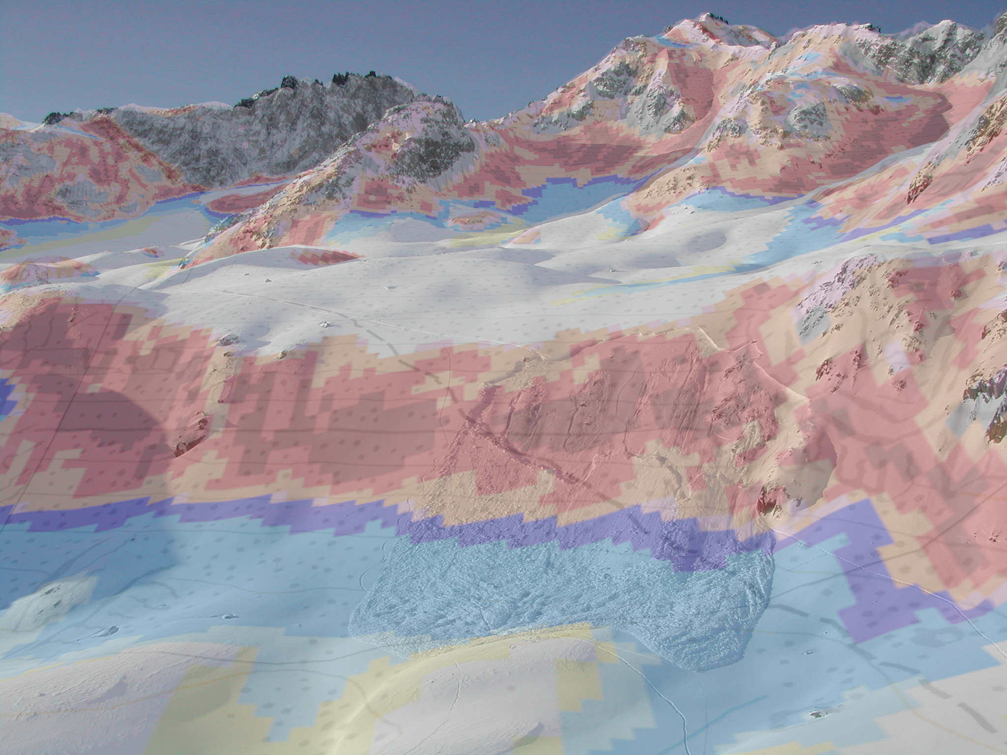
Topographic maps are the basis for a good terrain assessment and route selection. However, interpreting the terrain from the map is not easy and limited. Valuable additional information is provided by high-resolution digital elevation models, from which various map layers can be derived. In particular, layers with slope classes are now standard and essential for terrain assessment. In addition, map layers have recently been developed that represent the avalanche terrain in all its complexity. It is crucial to distinguish between:

  • safe terrain,

  • potential release areas,

  • terrain with potential for remote triggering,

  • possible runout zones of typical human triggered avalanches,

  • terrain where the potential for deep burial or serious injury is high.

Currently, there are two map layers (CAT and ATH) that map and classify the potential avalanche terrain for typical human triggered avalanches. These map layers can be displayed on White Risk Tour for tour planning. The automatic detection of possible cruxes is based on this additional information.

Read more:

Access to the map layers

Both avalanche terrain maps are integrated as layers in White Risk TOUR and are available with a standard licence. To use them offline with the White Risk app, the corresponding map sections must be downloaded.

The maps can also be browsed online with the following links on map.geo.admin.ch.

Classified avalanche terrain, CAT

Avalanche terrain hazard, ATH

Capabilities and limitations of the maps

Avalanche terrain maps add value to slope incline maps by showing where avalanches occur and highlighting areas away from the steep terrain that pose a potential danger. When a user draws a route on the map or breaks trail in the field, for instance, he can distinguish between favourable and unfavourable terrain and assess how far a typical human triggered avalanche might flow. At the same time, the following limitations apply:

  • The maps depict avalanche situations in which small to large (size 3), but not very large, avalanches are to be expected. According to this assumption, terrain without any colouring is relatively safe.

  • Narrow ridges are likewise not coloured in many cases. Places such as these can, however, pose a danger because of other hazards, including cornices or the risk of falling.

  • Terrain in forests classified as “dense” is disregarded, whereas wooded areas regarded as “open” are treated as unforested terrain. No consideration is given to the actual dynamic nature of the forest structure. In reality, forest structure is dynamic, which has different implications for its formation and dynamics. The forest/non-forest distinction was made based on a vegetation height model developed by WSL.

  • Differences in aspect and elevation as well as terrain with a gradient of more than 50°, are disregarded.

These maps consider only the static terrain, but not the current avalanche situation.

See more information at:

Harvey, S. et al. 2018: Avalanche terrain maps for backcountry skiing in Switzerland. ISSW 2018